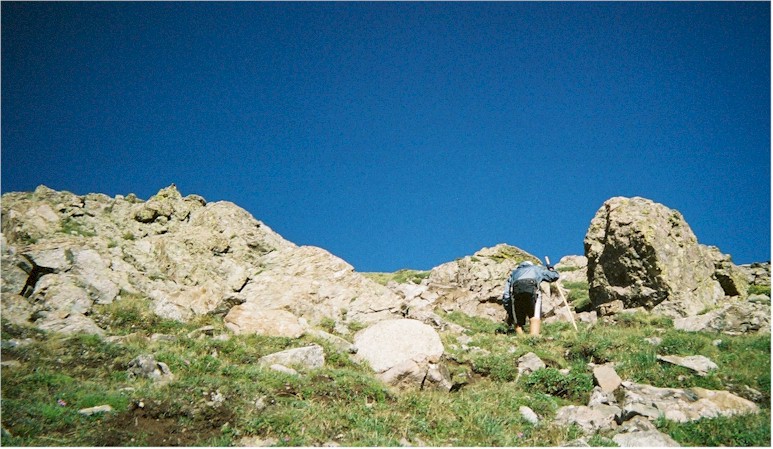
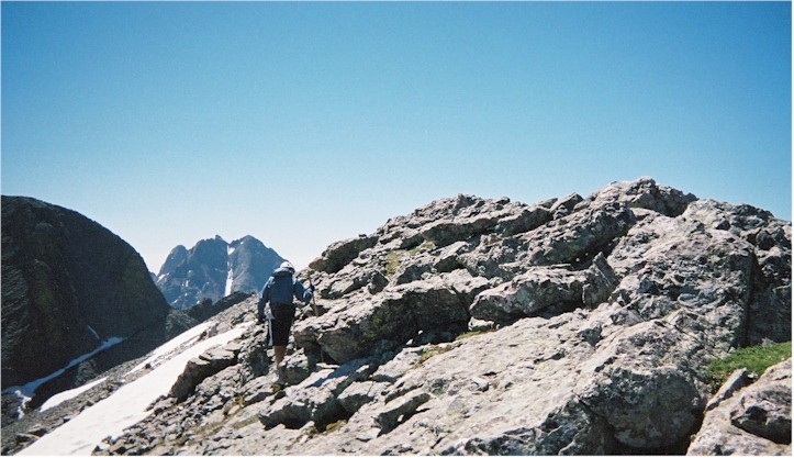
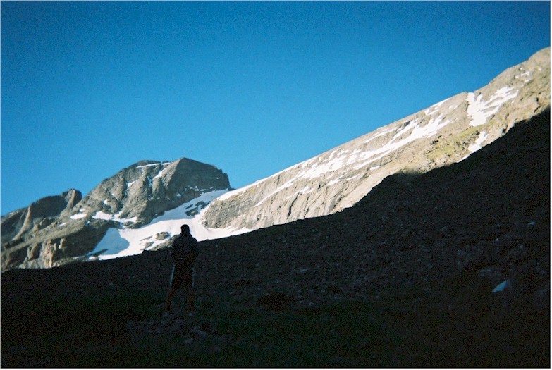
Summit Assault Day, 6:30 am. Spencer looks at Kit Carson Peak (14,165'). Challenger Point (14,080') is closer, but lies behind the ridge shown here and can't be seen yet. Our route to the ridge would generally follow the sunlight boundary in this photo.


Here's a good view from the north, taken by a Mt. Adams climber, of the face we're about to climb. You basically gain the ridge just under and to the right of the largest cloud in this photo, then take the ridge straight back to the summit.


Spencer heads west up some grassy slopes on the north end of the ridge.


After gaining the ridge, the Standard Route takes you to its steep west side and across four gullies. Spencer looks up, in lieu of down.


This traverse was fun, but also contained the highest pucker factor. The shiny "trail" across it has been formed over the years by hundreds of hiking boots grabbing a friction hold.


This photo of the same traverse, from another climber's trip report, better captures the look and feel of the spot as you go across.


After jumping back over to the east side of the ridge, the view of Challenger's summit gave us encouragement.


We made it ! Spencer sits by the Challenger Crew Memorial and waits with his camera for a marmot to re-appear.


We looked back north and were treated to a great view of the Sangres.


Happy but tired. Another arms-length Freeman summit photo.


Challenger Point is a great vantage point for views to the South of Kit Carson Peak and the Crestones. The snow-filled ledge angling up near Spencer's right elbow is called Kit Carson Avenue. It's how you access Kit Carson Peak, but the snow would block any attempt on this day. We were watching some other climbers struggle to make it over the icy snow slanting across the ledge. They were unsuccessful.


Taken from another climber's trip report, here's what Challenger Point, where we're standing, looks like from Kit Carson Avenue.


go to page 3


back to home page